More heavy rain and strong storms move in this weekend in Pittsburgh
Parts of our area received locally heavy rain yesterday afternoon and evening as strong storms moved through. Rainfall amounts of 1- 3+ inches occurred in Central and Eastern portions of Allegheny County, far western Westmoreland, and Lawrence County, as well, prompting flash flood warnings along with several flooded roadways and road closures.
WEATHER LINKS:
Current Conditions | School Closings & Delays | Submit Your Weather Photos
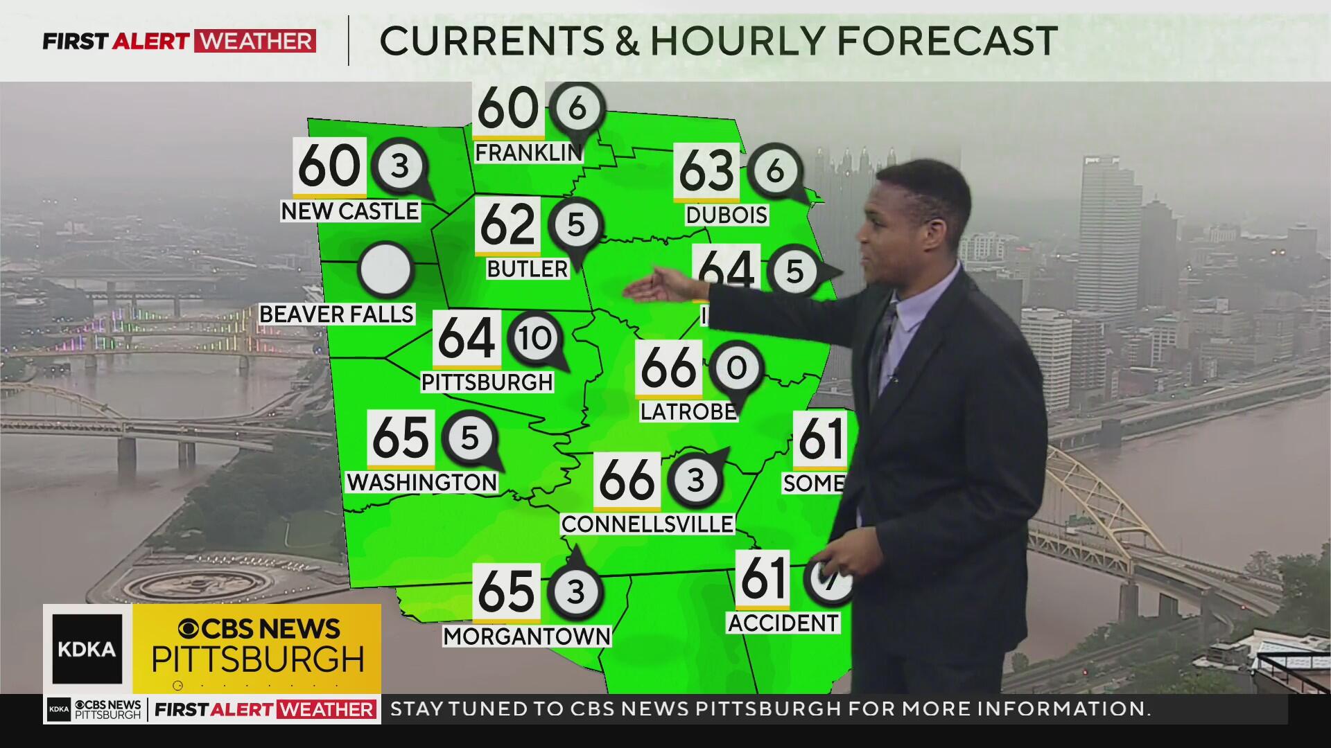
The bulk of the heavy rain associated with yesterday's storms has moved south toward the I-70 and I-68 corridors this morning. Showers will continue in our coverage area until 10-11 a.m. along with some areas of dense fog, followed by partial clearing later.

The stationary front that bisected our region yesterday has turned into a cold front and will continue to slowly push south as the morning and early afternoon hours progress. Dry air is moving in behind the front and should lead to slightly more comfortable conditions and several dry hours from midday into the afternoon and evening hours, although we will still leave in a chance for a stray shower.

Our next system to keep an eye on for Sunday is currently out in the Central Plains. This will move east tonight into Sunday, bringing in our next opportunity for rain and storms on Sunday. Rain showers will begin before dawn in our southern and western counties, then spread east through the day and into the afternoon and evening.
For most areas from Pittsburgh and points northwest, a general steady soaking rain is expected. Closer to the track of a low-pressure center that will likely skirt along the I-70 corridor, this is where lift and moisture convergence will be higher to support heavier rainfall rates and the potential of an isolated severe storm.
There is a flash flood risk for Sunday afternoon, as 0.5"-1.5" of rain within 1 hour is enough to cause flooding, especially in areas that have already received heavy rain on Thursday and Friday.

Most of the rain will end between 7 p.m. and midnight Sunday, with a brief break in the activity from Sunday night into Monday morning. Light winds, cool temperatures, and very moist grounds will lead to some fog on Monday morning for a few hours.
Winds will begin to increase out of the southwest through the day ahead of another strong low-pressure system and cold front moving in from the west. Unlike the past few days, where we haven't had much wind shear, wind shear will be much higher on Monday, leading to more organized and longer-lasting storms. The most likely timing for storms on Monday will be from 12 p.m. through midnight.
A few storms may be severe with damaging winds, hail, and an isolated tornado threat as well. An additional 0.5" to 1.5" of rain is likely on Monday into Monday night, with more flash flooding possible.
After some lingering showers Tuesday morning and midday Tuesday, we'll get a push of drier air in from the west, and that will lead into several dry days for the middle to later portions of this week.

Stay up to date with the KDKA Mobile App – which you can download here!


